Surveying Services

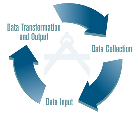
Surveying requires the right people with the right equipment. We maintain state-of –the-art equipment to ensure our highly trained surveyors have the right tools for the job. We follow a three step process to our boundary and topography work.We conduct land surveys, title surveys, construction surveys, building alignments, municipal street utility easements and rights of way layouts.
- Data collection – we collect most date through a total Station with an attached data collector or a GPS based receiver.
- Data Input – our data collectors are linked ao t PC and in minutes all the data is downloaded and ready for the next step.
- Data transformation and output – Once data is transferred to the PC, technician transforms the field data with CADD into drawings and plans of the boundary surveys, subdivisions and site stakeout.


 Surveying requires the right people with the right equipment. We maintain state-of –the-art equipment to ensure our highly trained surveyors have the right tools for the job. We follow a three step process to our boundary and topography work.We conduct land surveys, title surveys, construction surveys, building alignments, municipal street utility easements and rights of way layouts.